East Fen Common
Objective and outcome of the task
These were the first flights and missions flown after receipt of the Mavic 3E aircraft. An initial first flight was performed to check the basic airworthiness and functionality of the aircraft. Then three missions were flown over East Fen Common to test fly the aircraft as a mapping tool and to gather data on the variation of photograph, 2D map and 3D model quality with aircraft speed, altitude & camera settings during an autonomous mapping mission to aid proper mission, aircraft and camera set-up for future tasks.
During the initial basic airworthiness and function flight test the aircraft operated and performed as expected and hoped. During the mapping missions the waypoints were flown as planned and without any technical or operational issues. The 2D maps presented below show some variation in the broad characteristics such as vegetation & feature colours when zoomed out, but most of the differences are only visible when zoomed in and more detail has been captured with faster shutter speed, lower aircraft speed & altitude, and auto-focus enabled. Depending on the task requirement map and model fidelity can be traded-off with aircraft speed and height, a faster mission can be achieved by a reduction in map and model accuracy.
The mapping area was defined to cover 63000 sqm (6.3 hectares/15.5 acres) of the fen with a lower likelihood of human or animal incursion during a mission. The flying times equate to 1.2 hectares/3 acres per minute, 0.9 hectare/2.2 acres per minute, & 0.4 hectares/1 acre per minute, respectively.
How the data was gathered and processed
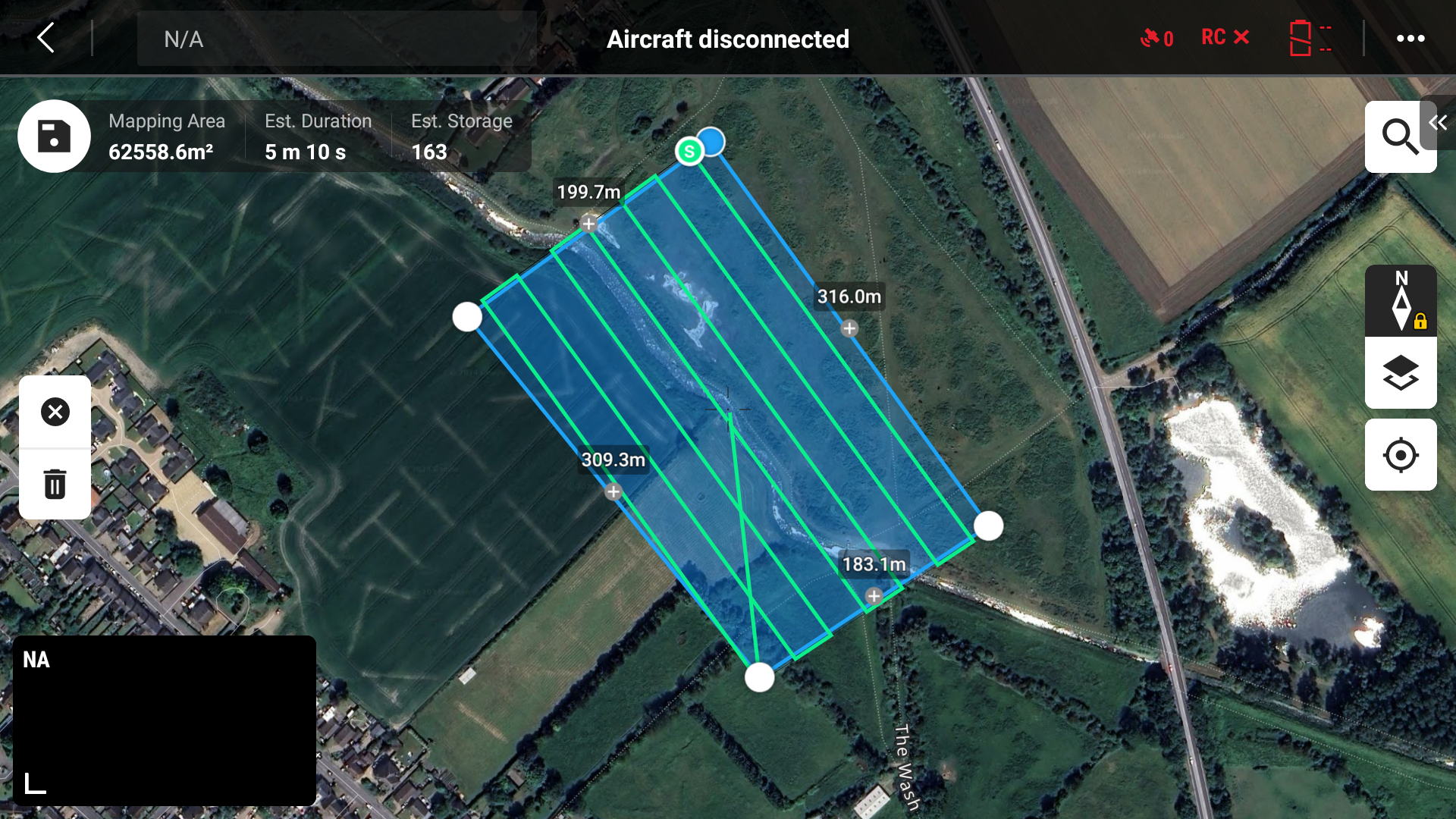
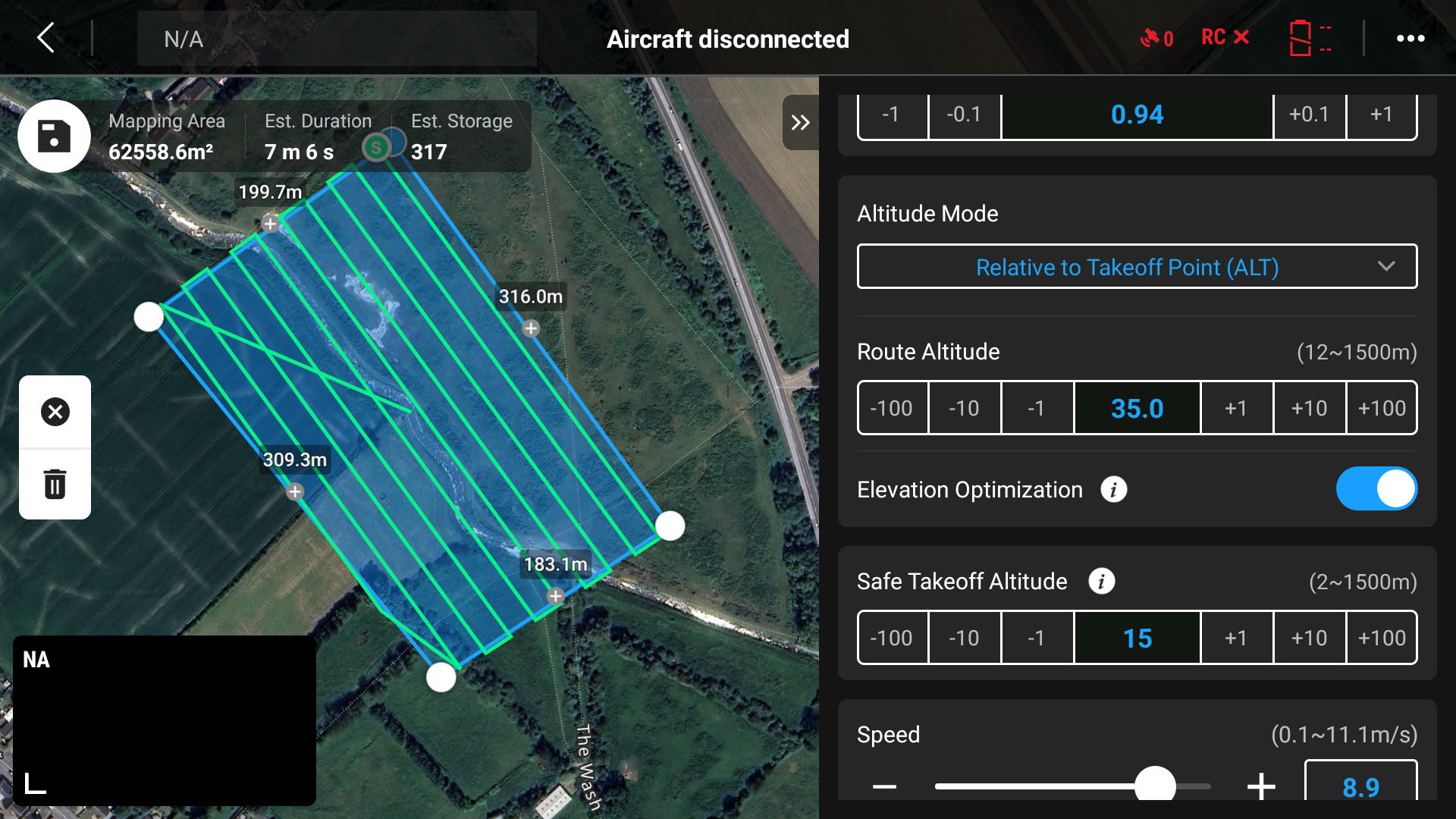
For the first mission the DJI Pilot 2 basic ortho mission type was selected, retaining the default aircraft speed and camera settings for a selected height of 50m. The airspeed default for this mission was 9m/s. For the second and third missions the same mission area was used, but with combinations of altitude and forward speed of 35m & 9m/s and 35m & 4m/s. The camera auto-focus function and aperture speed settings were also varied.
Mission 1 (50m & 9m/s)
Mission 2 (35m & 9m/s)
Mission 3 (35m & 4m/s)
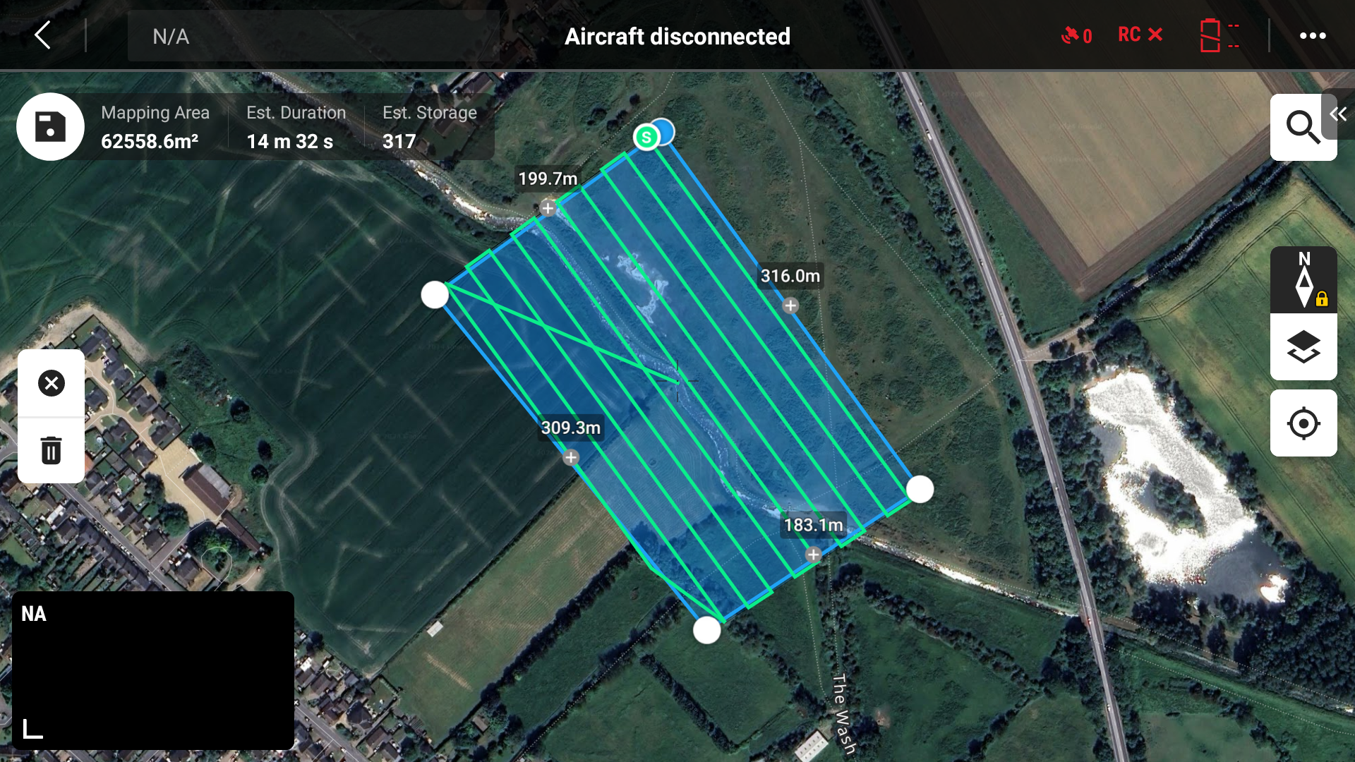
The missions took approx. 5, 7 & 15 minutes elapsed flying time respectively, and 158, 431 & 431 photos (respectively) were captured during the three passes over the site. The photos were processed using the DJI Terra app, taking just over 16, 46 & 46 (respectively) minutes of processing time on a Windows 11 PC with a 32-core Intel Core i9-14900 processor, 64GB of RAM and an Asus Nvidia 4060 GPU.
2D Map
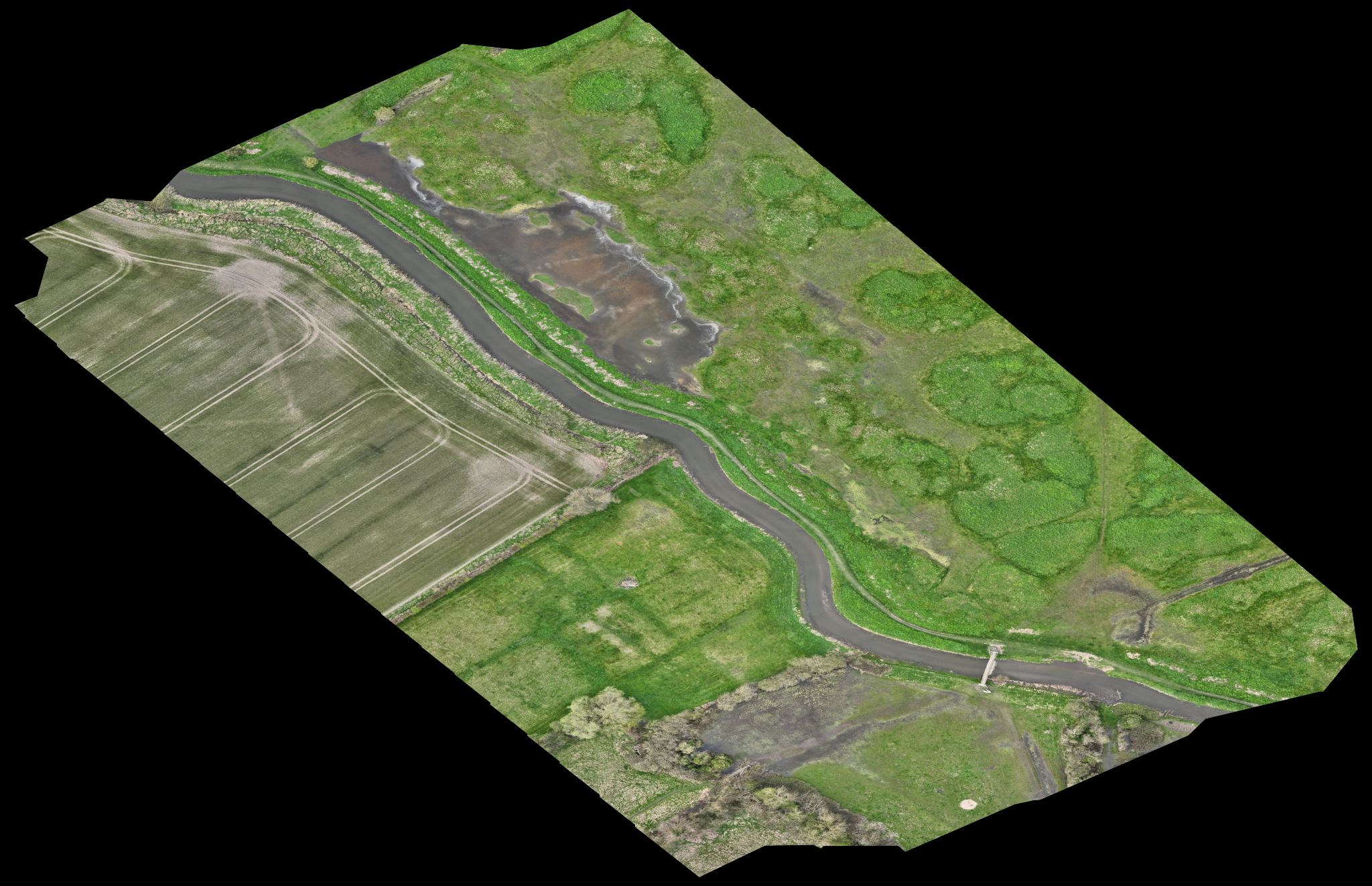
The 2D map was output by DJI Terra app as a GeoTIFF file. The GeoTIFF was used to create PDF and JPG files of the 2D ortho-mosaic and uploaded into Google Earth Pro to create a geo-referenced tile overlay on the Google Earth globe. This can help visualise the subject in its surroundings.
The GeoTIFF is also a very detailed ortho-mosaic image and can be examined to understand the condition of the subject, e.g. vegetation cover, vegetation health, water level, flooding, paths, livestock, bridges, etc.
Mission 1 (50m & 9m/s)
Mission 2 (35m & 9m/s)
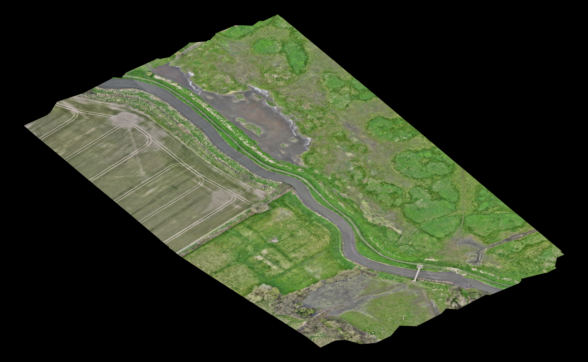
Mission 3 (35m & 4m/s)
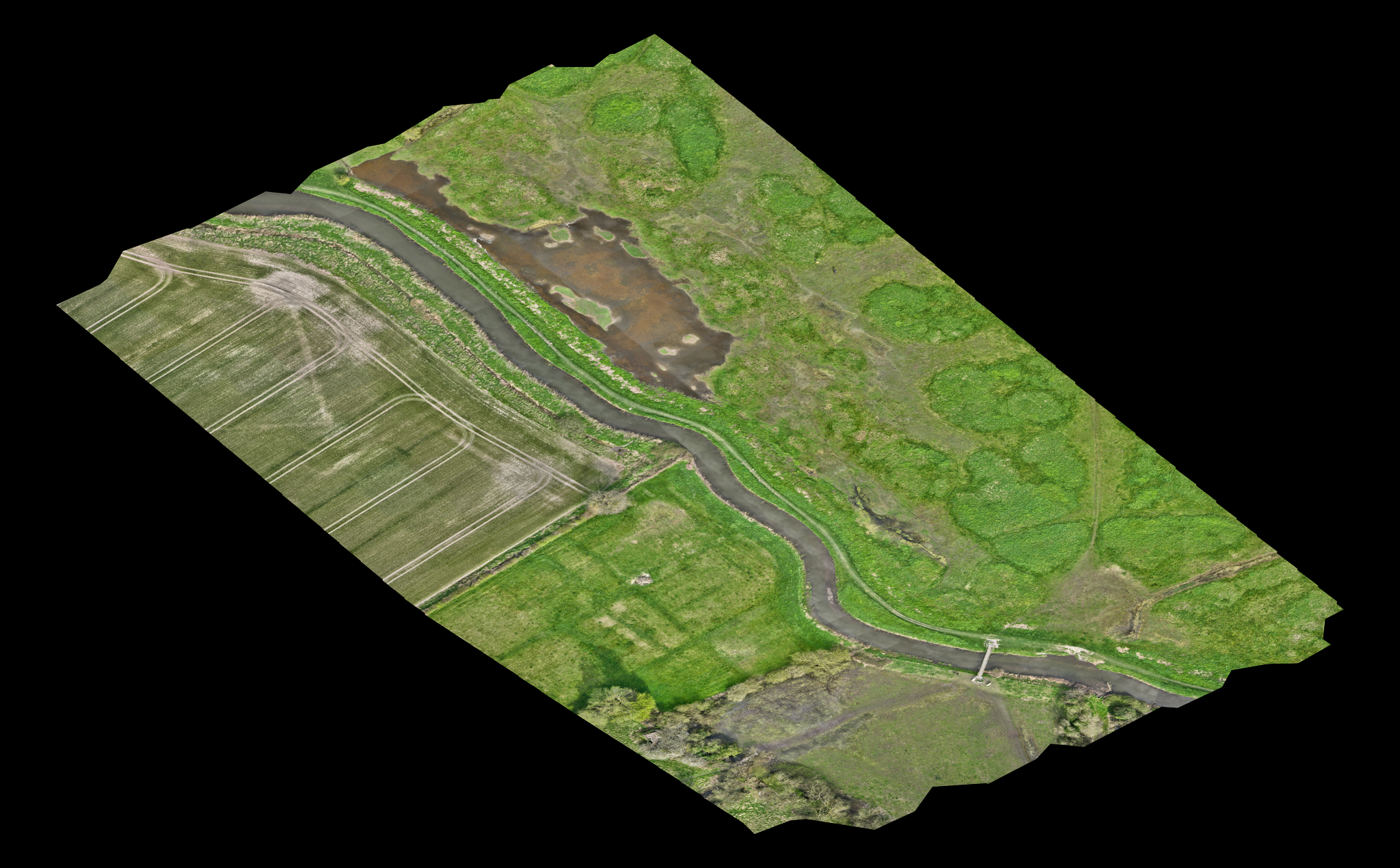
3D Model & animation
The 3D model can be examined to enable measurements of distance, area, volume and slope to be taken; these have been verified to be within millimetres of the actual values.
The 3D model was shared as a link from the DJI Modify app, to be viewed in a web browser. Animation of the model in the viewer was screen recorded. (The viewer can navigate around the model using the mouse. The 3D model can also be output to a number of formats compatible with various CAD, GIS, etc. apps.)
If you are interested in any of our services click here to email us
Airborne Insights is a trading name of Logistics Partners Consultancy Limited


