Solar Farm
Objective and outcome of the task
The primary objective was to gather photographs which could be used to create a 2D map & 3D model of a solar farm. The secondary objective was to use the Pix4Dmapper to evaluate its relative performance, functionality & ease of use versus DJI Terra.
The 2D map shows the layout of the PV panel tables, service tracks and ancilliary buildings on the site for DC-AC converters, grid connection & maintenance equipment, spares, etc.
The 3D model is also a good representation of the site in digital form which can be viewed from all perspectives and zoomed to show details. The 3D model could be used to aid understanding the condition of the site and the maintenanace, repair & updating requirements. Also site security and safety planning, etc.
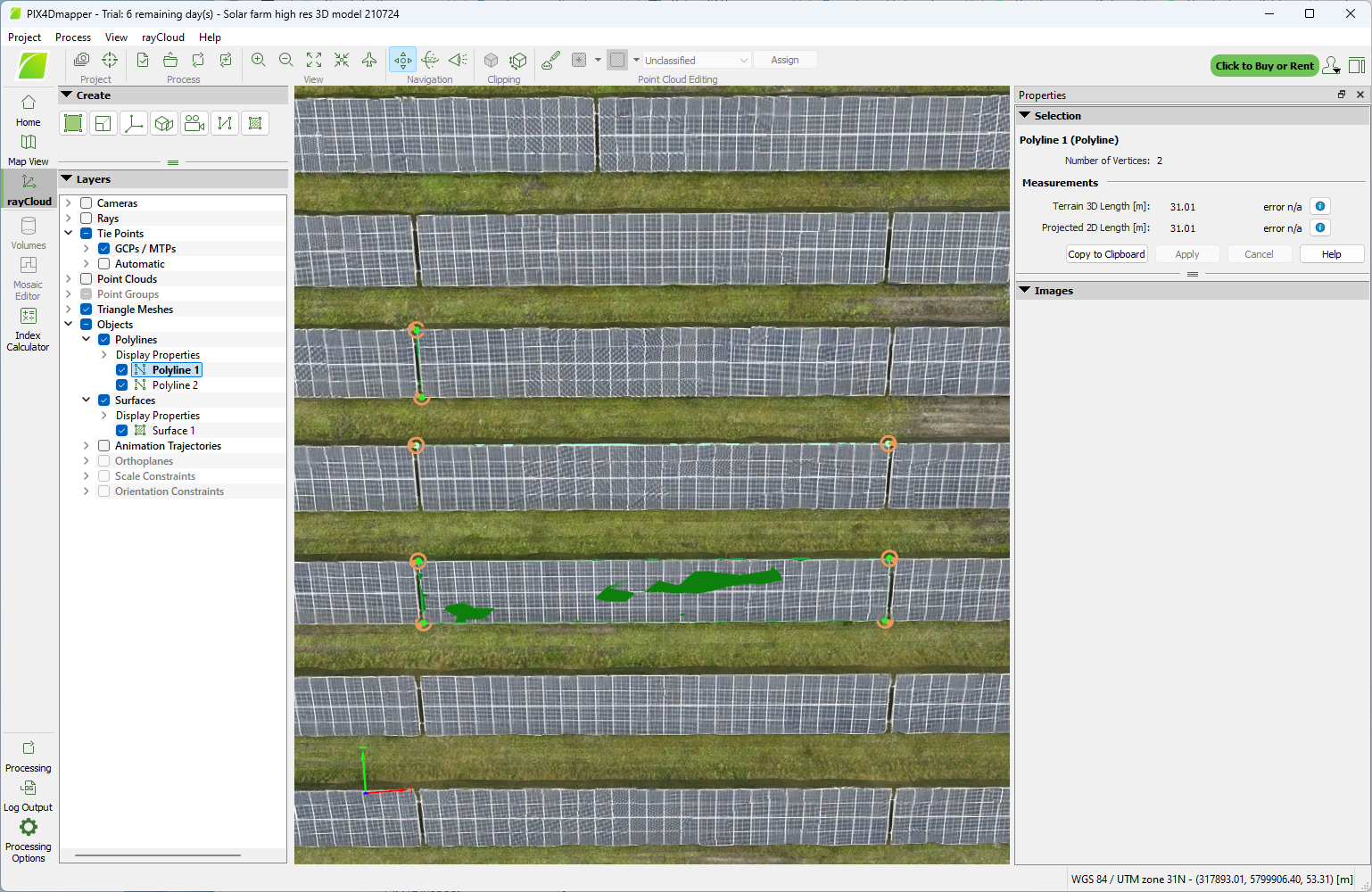
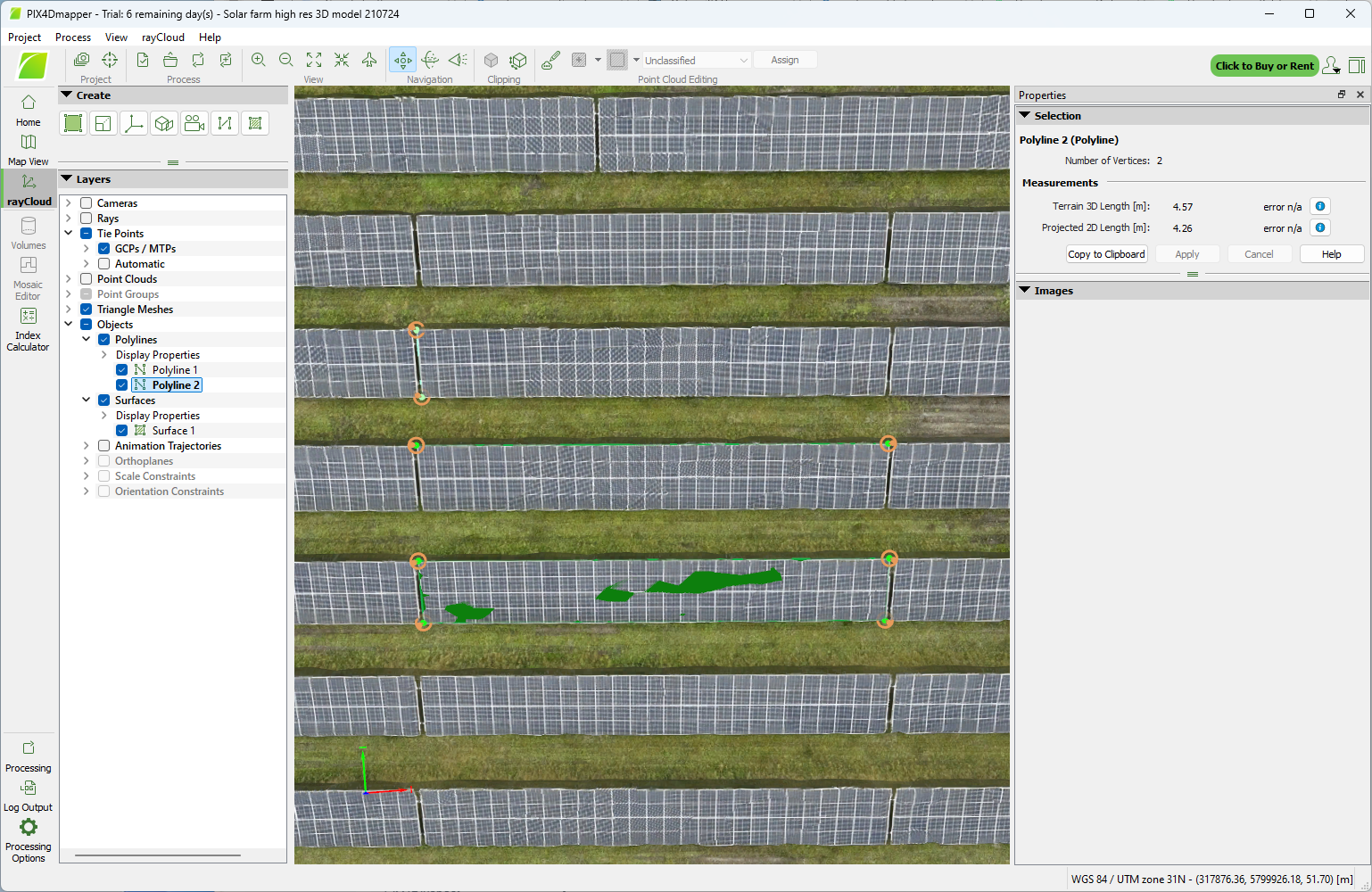
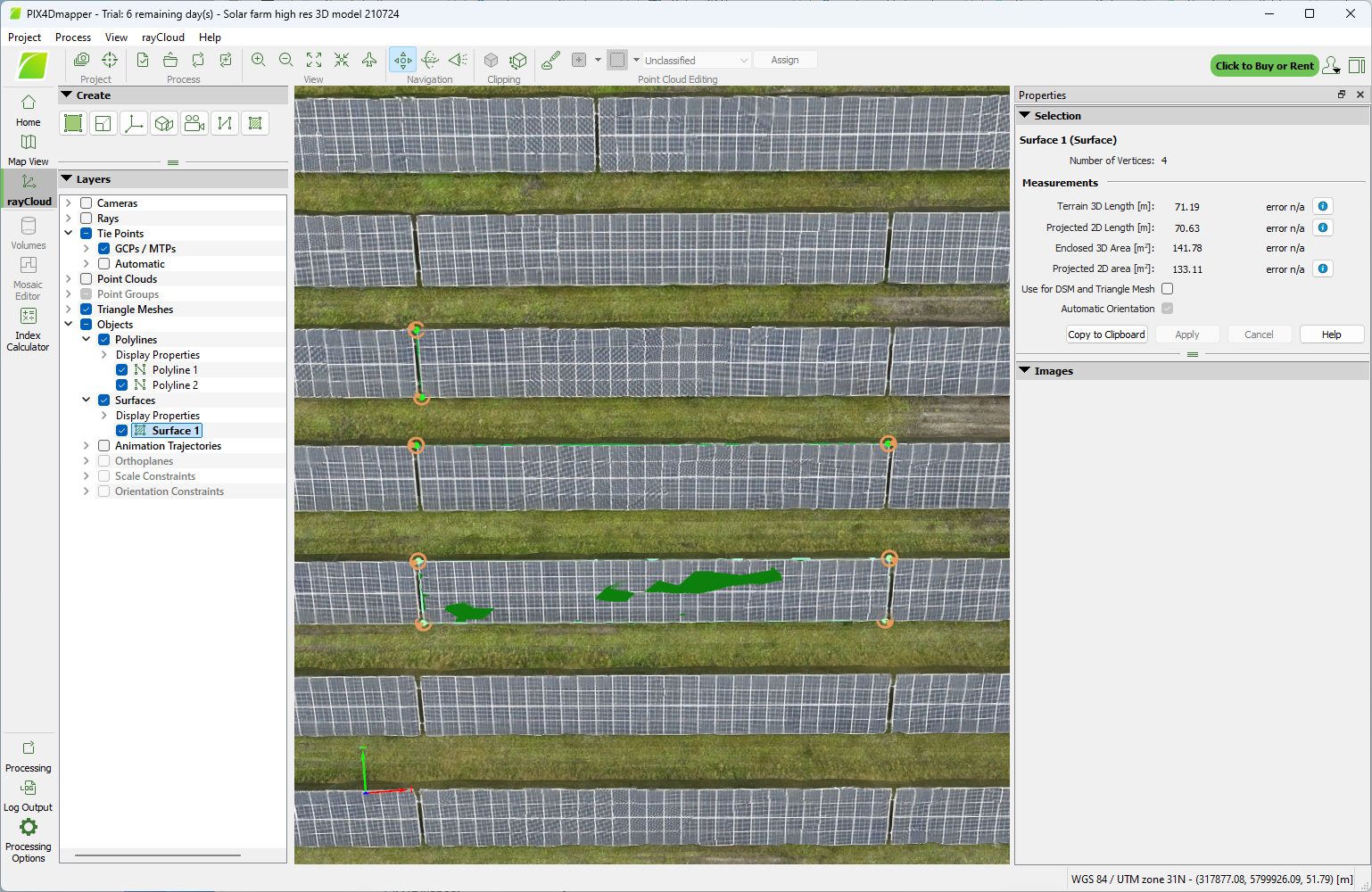
The 3D model was examined using the polyline and surface functions to derive PV panel table dimensions and surface area (31m, 4.6m & 142m^2, respectively).
How the data was gathered and processed
This was flown as a standard DJI Ortho waypoint mission which is efficient for both flying time and number of photos, but it limits the accuracy of a 3D model. The site is located near a railway line and electricity transmission cables, and is itself a sensitive site regarding safety and security, so care was taken to ensure the aircraft was in good working condition, was functioning correctly, had a good signal between RC & aircraft, and capable of being flown safely within line of sight at all times.
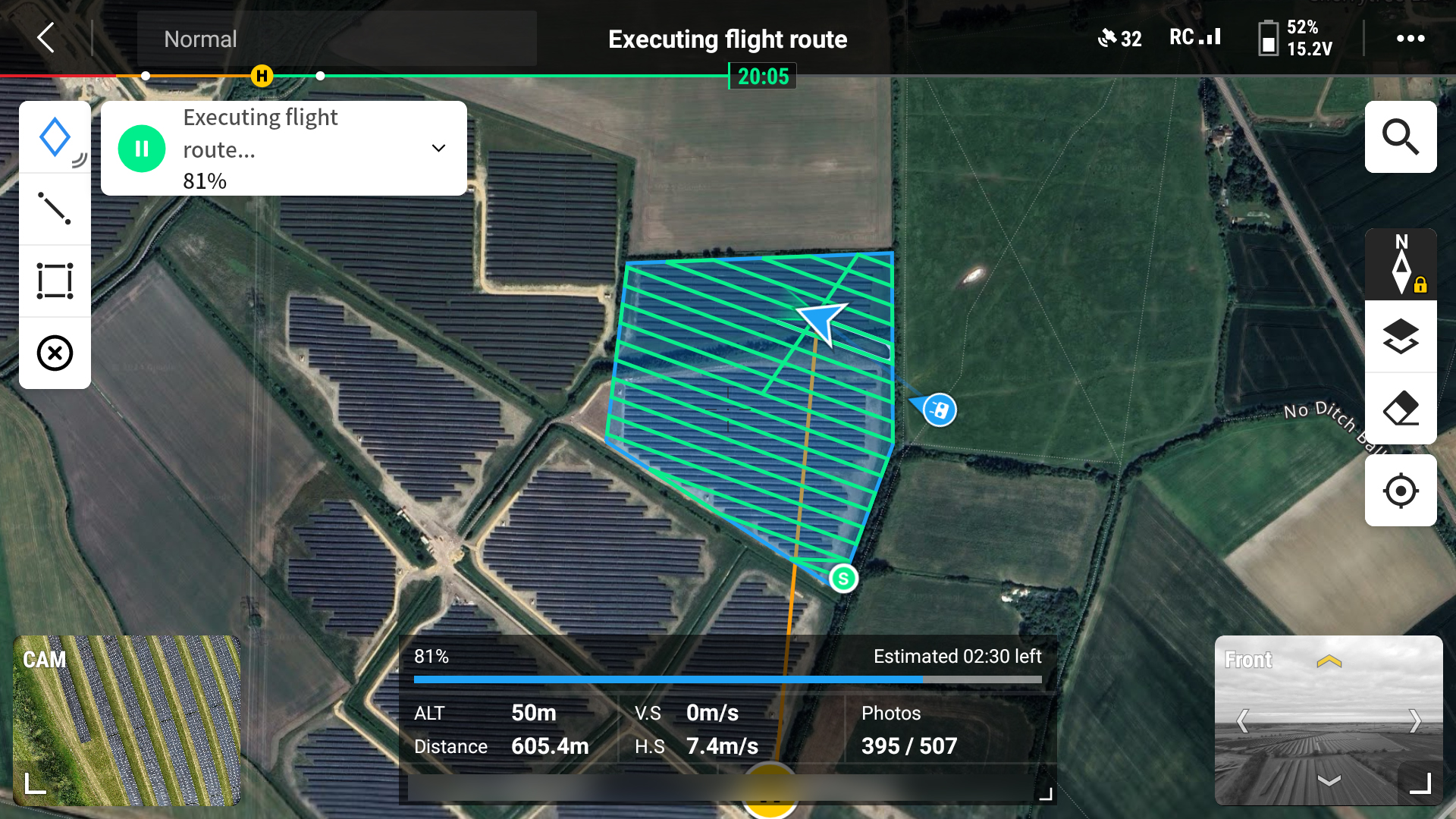
The mission took just under 10 minutes to fly, and 507 photos were captured . The photos were processed using the Pix4Dmapper app, taking about 95 minutes of processing time on a Windows 11 PC with a 32-core Intel Core i9-14900 processor, 64GB of RAM and a Asus Nvidia 4060 GPU. It was observed that Pix4D makes much less use of the GPU unless it is configured to produce higher accuracy results (over a longer processiong time). As a result Pix4D was noticeably slower than DJI Terra for the lower resolution processing and outputs, but more comparable for the higher resolution processing and outputs.
In terms of functionality and user interface, DJI Terra is much simpler and easier to use. Pix4Dmapper has a more traditional look & feel, but it also gives the user much more information as the processing progresses. Pix4Dmapper appears to be more configurable than DJI Terra, but this may be less useful than it might seem. The option to have faster but less accurate results was tempting but there is a possibility of image calibration errors in the faster processing configuration than would be seen in the slower processing config, due to trade-offs in image resolution. Due to inexperience with Pix4Dmapper this resulted in re-flying of the mission, but for no gain.
2D Map
The 2D map was output by Pix4Dmapper as a GeoTIFF file. The GeoTIFF was used to create PDF and JPG files of the 2D ortho-mosaic and uploaded into Google Earth Pro to create a geo-referenced tile overlay on the Google Earth globe. This can help visualise the subject in its surroundings.
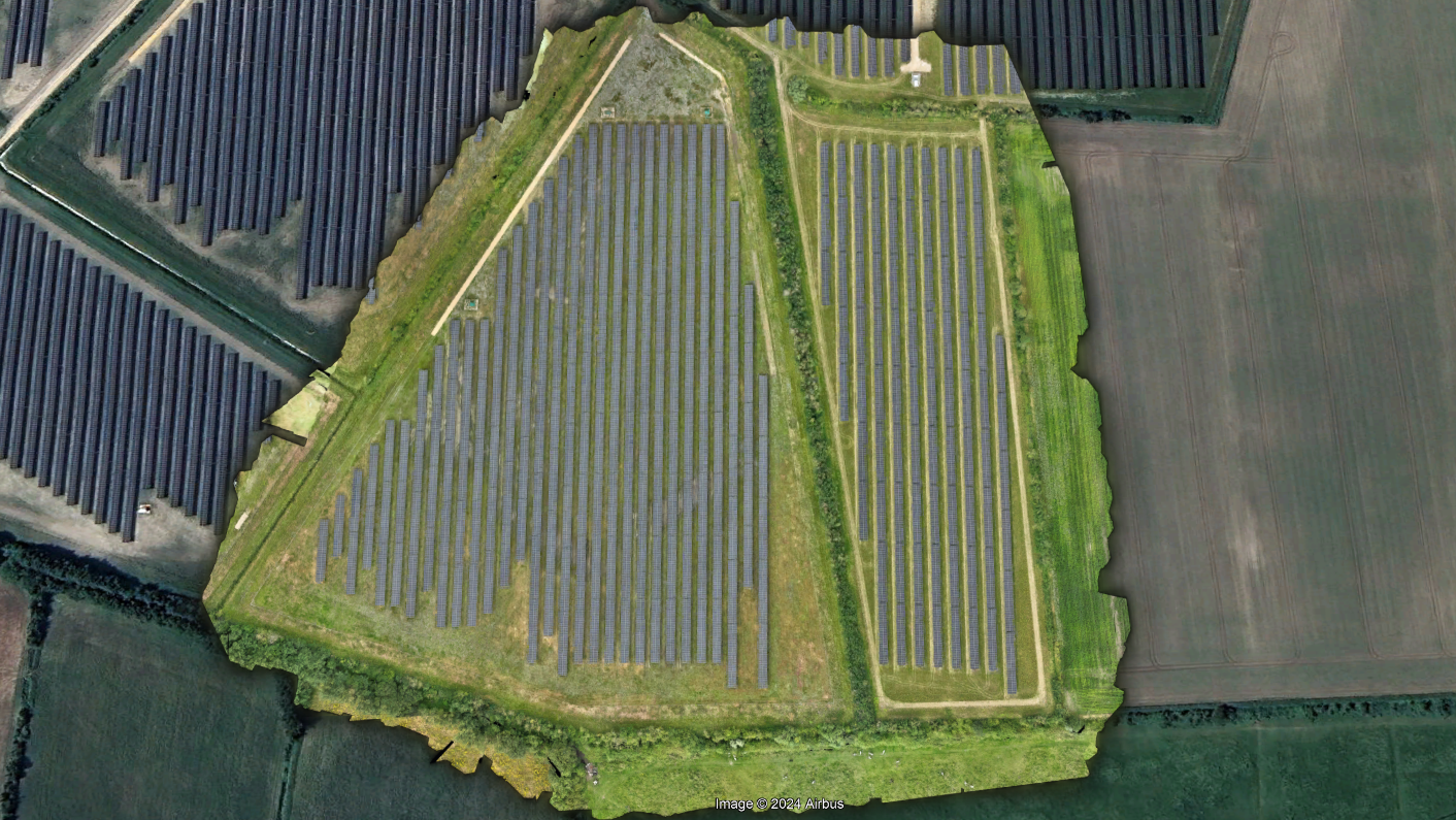
The GeoTIFF is also a very detailed ortho-mosaic image and can be examined to understand the condition of the subject, e.g. damage to PV panels, table framework, ancilliary buildings & access tracks, vegetation growth, site security, etc.

3D model & animation
The 3D model can be examined to enable measurements of distance, area, volume & slope, these have been verified to be within millimetres of the actual values.
The 3D model was created from a series of viewpoints selected in the Pix4Dmapper animator function and rendered to a MP4 file. The 3D model can also be output to several file formats compatible with various CAD, GIS, etc. apps.
Orbit Video
A video was taken live during a manually orbit flown around the site. This can be compared to the animation shown above to appreciate the fidelity of the data gathered and the photogrammetric processing used to create the 2D map and 3D model.
If you are interested in any of our services click here to email us
Airborne Insights is a trading name of Logistics Partners Consultancy Limited


