Masters Logistical Services Ltd site
Objective and outcome of the task
Logistics Partners has previously worked with Masters Logistics and agreed to fly a mapping mission over their site in Stretham. The primary objective was to gather photographs which could be used for marketing & promotion and secondary objectives to create a 2D map of a larger roof specifically and 3D model of a larger commercial site generally.
A pack of twelve photos and three videos were delivered to the customer to be used for print and digital (social) media networking and promotion.
The 2D map shows a well maintained roof that has no obvious or significant damage and has been partially upgraded relatively recently.
The 3D model is also a good representation of the site in digital form which can be viewed from all perspectives and zoomed to show details. The 3D model could be used to aid further development of the site, site security and safety planning, understanding the condition of the roof and walls without having to exit the building or even be on site, etc.
How the data was gathered and processed
Previous Airborne Insights mapping missions were undertaken using the standard DJI Ortho and Smart Oblique waypoint mission types which are both efficient for time and number of photos. However, in the surrounding environment of this property it was difficult to arrange the two perpendicular flight legs to avoid overflying a residential property immediately adjacent to the site and a busy main road, and two communications towers and a single tall tree. Consequently, the standard oblique mission was used to avoid all the obstacles.
The height of the buildings and the length/width of the site presented a challenge to ensuring the drone always remained within sight. To achieve this a remote pilot and an observer were deployed, constantly moving around the site and always staying in visual and voice contact.
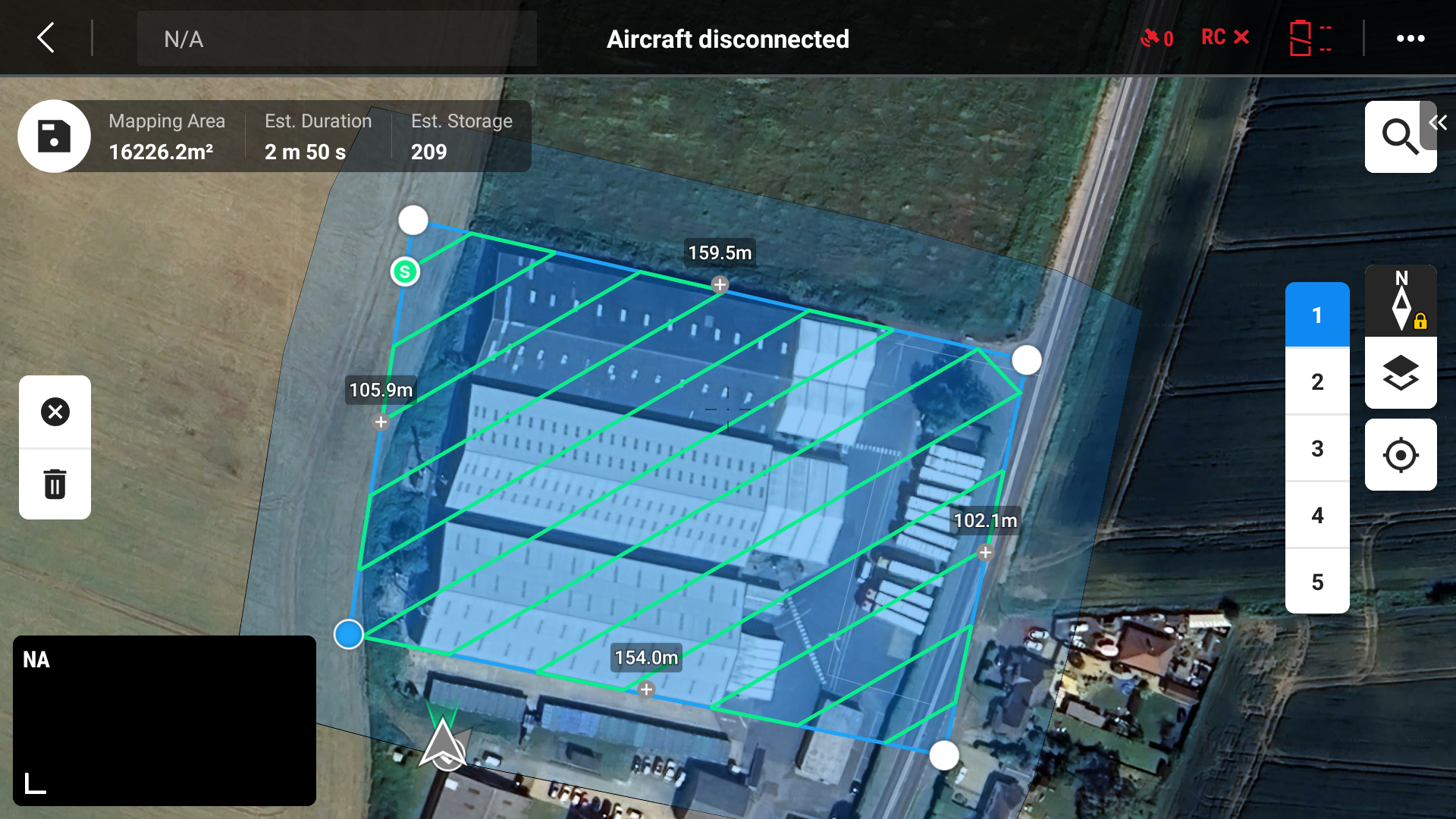
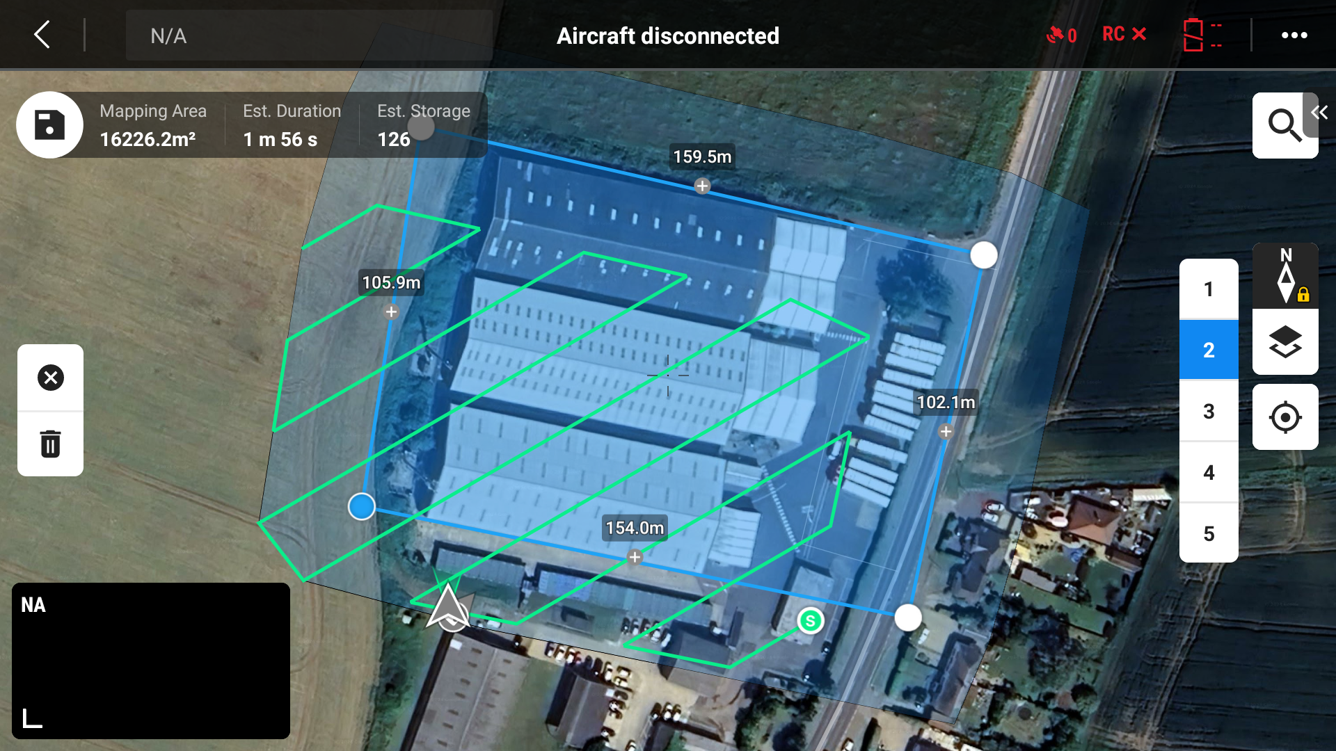
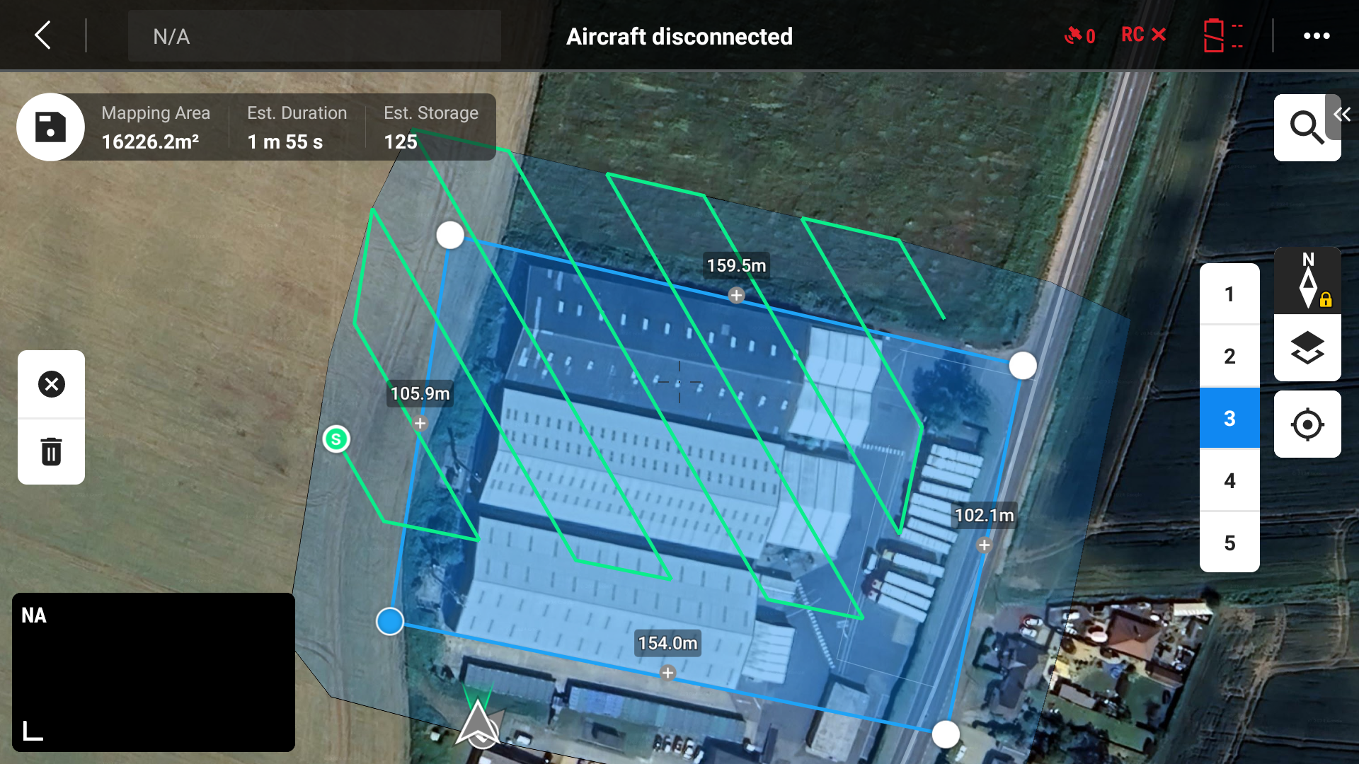
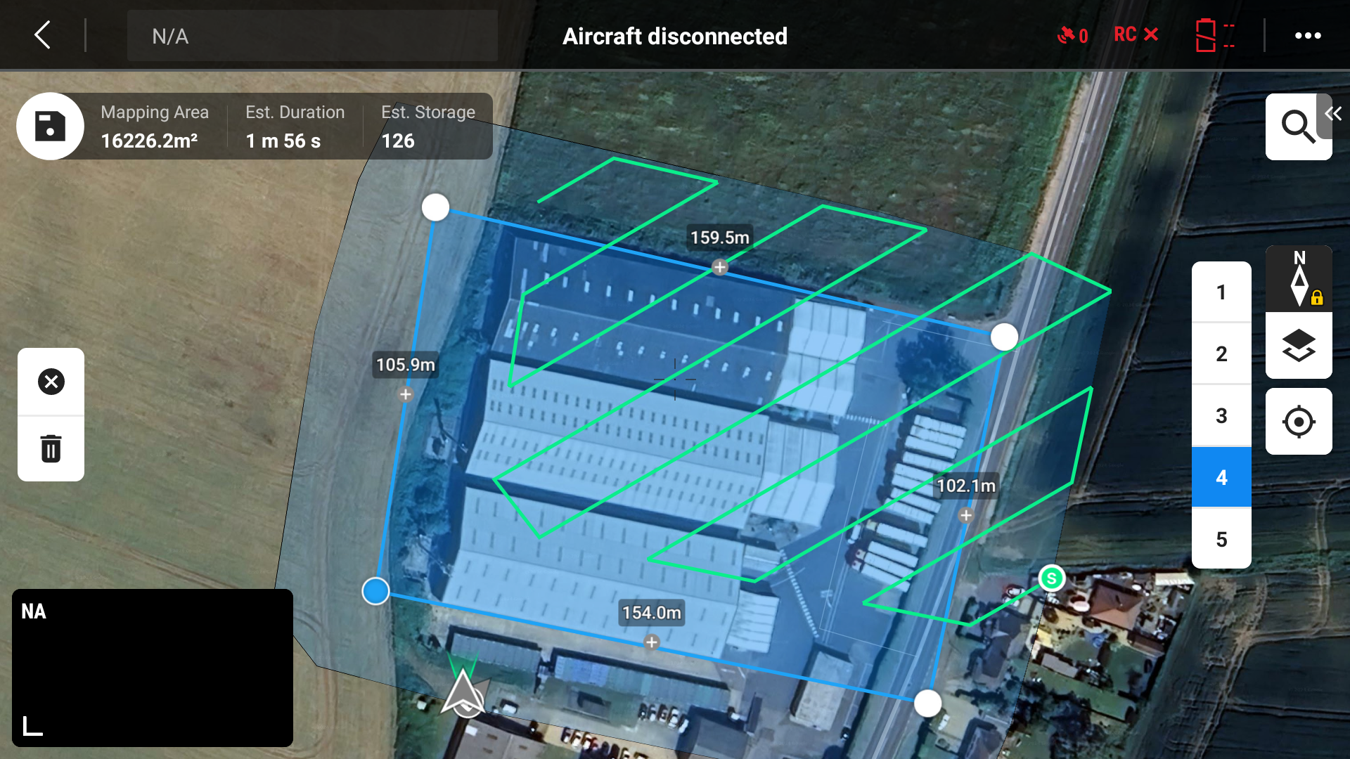
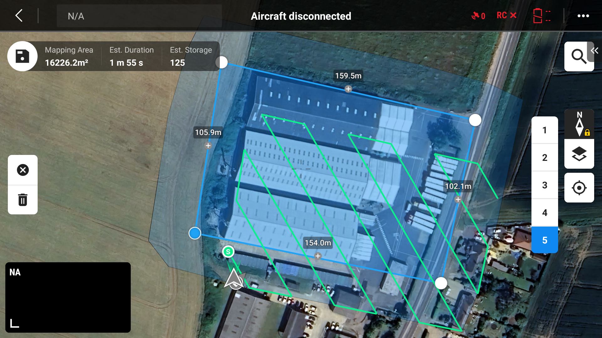
The mission took just under 11 minutes to fly, and 697 photos were captured during five passes over the site. The photos were processed using the DJI Terra app, taking about 70 minutes of processing time on a Windows 11 PC with a 32-core Intel Core i9-14900 processor, 64GB of RAM and a Asus Nvidia 4060 GPU.
2D Map
The 2D map was output by DJI Terra app as a GeoTIFF file. The GeoTIFF was used to create PDF and JPG files of the 2D ortho-mosaic and uploaded into Google Earth Pro to create a geo-referenced tile overlay on the Google Earth globe. This can help visualise the subject in its surroundings.
The GeoTIFF is also a very detailed ortho-mosaic image and can be examined to understand the condition of the subject, e.g. damage to woodwork, masonry, brickwork, roof tiles/panels, etc.

3D model animation
The 3D model can be examined to enable measurements of distance, area, volume & slope, these have been verified to be within millimetres of the actual values.
The 3D model was shared as a link from the DJI Modify app, to be viewed in a web browser. Animation of the model in the viewer was screen recorded. (The viewer can navigate around the model using the mouse. The 3D model can also be output to several file formats compatible with various CAD, GIS, etc. apps.)
Orbit Video
A video was taken live during a manually orbit flown around the site. This can be compared to the animation shown above to appreciate the fidelity of the data gathered and the photogrammetric processing used to create the 2D map and 3D model.
Live 3D model
A live version of the Warehouse 3D model is available here. The model can be navigated to examine details of the property.
To rotate the model, press and hold the left mouse button; to translate the model, press and hold the left mouse button and a shift key; and to zoom the model in & out, use the mouse scroll wheel.
This is a reduced fidelity (but still 100s MB) version of the 3D model, but it will still take 15-20 seconds to load and initially only a white screen with a set of x, y & z axes will be shown. When the model loads the view starts below the model, so to bring the building into view click the left mouse button and drag down a few centimetres.
If you are interested in any of our services click here to email us
Airborne Insights is a trading name of Logistics Partners Consultancy Limited


